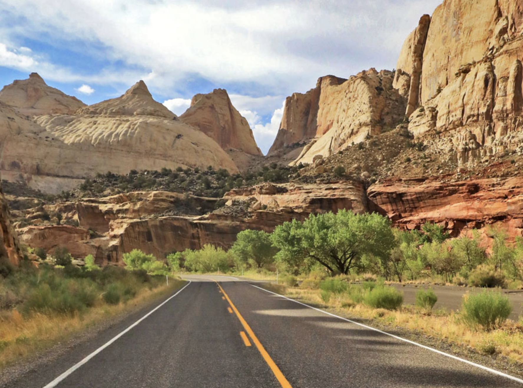
Torrey, Utah / Plan / One day
Built backwards from the parking lot
One Day in Capitol Reef
One day in Capitol Reef is genuinely enough, but only if you get two things right. The Park Service says trailhead parking lots often fill up by 10 am. And every trail distance it publishes is a one way figure, which means the walk you are planning is twice as long as the number on the sign. This page is an hour by hour plan built around both, with real round trip distances for every trail.
If you read one section
Hike first, drive second, eat pie third
A good day here has three parts and the order is not negotiable. Hike in the morning while the parking exists and the rock is still in shadow. Drive the Scenic Drive late morning to early afternoon, because a paved road does not care how full the lots are. Save the Fruita meadow, the Gifford House and the roadside stops on Highway 24 for the afternoon, when they are the only things left that work in heat and crowds.
Almost every itinerary you will read puts the Scenic Drive first because it is the obvious thing. That is the mistake. The drive takes about 90 minutes round trip including both dirt spurs, and by the time you finish it the trailheads at the end of those spurs are full.
You do not need a guide for any of this. If you want one, a half day with somebody who knows where the light lands is a different kind of day, and the operators page lists everyone working here legally. But the plan below assumes you are driving yourself.
Coming for more than a day? The planning hub sequences a longer trip, and the month by month page has the thirty year weather record that decides how early you should start.
The one constraint that shapes everything
The park told you when the parking runs out
Capitol Reef publishes a page about its busy season, and it is unusually direct. Most visitors never find it.
Four sentences from that page are worth taking literally. Trailhead parking lots often fill up by 10 am. Grand Wash and Capitol Gorge parking lots off the Scenic Drive fill up early and cannot accommodate vehicles longer than 23 feet. Visitor center parking is limited. And the park's own advice: be flexible about which trail to hike, and when. If the parking lot is full, try again later.
The busy window is March to June and September to October. In July and August the parking problem eases and a different one replaces it, because afternoon highs average 91 and 88 degrees and the monsoon arrives most afternoons. Either way the answer is the same, which is why this plan starts early in every season.
A day that works in the busy months
7:00 am leave Torrey. It is 11 miles to the visitor center.
7:30 am at your first trailhead, whichever you chose below.
10:00 am back at the car, roughly when everyone else is arriving.
10:30 am Scenic Drive, both dirt spurs, about 90 minutes.
12:30 pm Fruita, the orchards, lunch at a picnic table.
2:00 pm Gifford House, visitor center, the park film.
3:30 pm Highway 24 stops on the way out, or a second short walk.
The same day, reversed, if you are not a morning person
Do the Scenic Drive at 8 am when the lots are empty and the canyon walls are still lit sideways, walk Capitol Gorge at the end of it, then take the afternoon for the long hike once the mid morning arrivals have cleared out around 3 pm. Trailhead parking frees up again late in the day, and evening light on the Waterpocket Fold is better than morning light anyway.
This version only works from roughly April to September, when there is enough daylight after 4 pm to finish a real hike.
The number everyone gets wrong
Every trail, at its actual round trip distance
The Park Service publishes its trail table as one way distances. Two loops are the exception and it marks them as such. So a trail listed at 2.3 miles is a 4.6 mile walk, and a great many itineraries published elsewhere quietly treat those figures as the whole hike.
| Trail | Park figure | Actual round trip | Climb | Park rating | Our time estimate |
|---|---|---|---|---|---|
| Goosenecks | 0.1 mi one way | 0.2 mi | Under 50 ft | Easy | 10 minutes |
| Sunset Point | 0.4 mi one way | 0.8 mi | Under 50 ft | Easy | 30 minutes |
| Capitol Gorge | 1.0 mi one way | 2.0 mi | 80 ft | Easy | 1 hour |
| Hickman Bridge | 0.9 mi one way | 1.8 mi | 400 ft | Moderate | 1 hour 15 |
| Fremont River | 1.0 mi one way | 2.0 mi | 480 ft | Moderate | 1 hour 15 |
| Cohab Canyon | 1.7 mi one way | 3.4 mi | 440 ft | Moderate | 2 hours |
| Grand Wash | 2.2 mi one way | 4.4 mi | 200 ft | Easy | 2 hours 15 |
| Cassidy Arch | 1.7 mi one way | 3.4 mi | 670 ft | Strenuous | 2 hours 30 |
| Chimney Rock Loop | 3.6 mi round trip | 3.6 mi | 590 ft | Strenuous | 2 hours 30 |
| Golden Throne | 2.0 mi one way | 4.0 mi | 730 ft | Strenuous | 3 hours |
| Rim Overlook | 2.3 mi one way | 4.6 mi | 1,110 ft | Strenuous | 3 hours 30 |
| Navajo Knobs | 4.7 mi one way | 9.4 mi | 1,620 ft | Strenuous | Most of a day |
The time column is ours, not the park's. The Park Service publishes no estimated hiking times for any trail here, and it is right not to. These are built from its own figure that the average person hikes about two miles an hour, with time added for climbing, and they assume you stop to look at things. Read them as a planning tool and not a promise.
The park's difficulty words are worth knowing because they are stricter than most people expect. Easy means uneven ground but fairly level. Moderate means a mix of steep grades and level sections. Strenuous means steep grades, uneven terrain and long, steady climbs. There is no fourth category, so everything hard here shares one label.
Two trails deserve a note. Cassidy Arch begins a few hundred yards in from the Grand Wash road parking area, so the walking is slightly longer than the figure, and it climbs with real exposure along high cliffs before ending on top of the arch. Grand Wash is rated easy and is nearly flat, but it is a wash, which means it is exactly the kind of place you do not want to be when a storm is anywhere in the region. The hiking page covers the whole trail system and the shuttle routes that turn some of these into one way walks.
Pick one
Three versions of the same day
They all fit in a day. They differ in how much walking you want to do and how much you mind other people.
The classic
Hickman Bridge at 7:30 am, 1.8 miles round trip to a natural bridge with the morning sun behind it. Back by 9. Scenic Drive and both spurs, including the short walk up Capitol Gorge to the pioneer register and the waterpockets. Lunch in Fruita. Gifford House. Petroglyph panel on the way out.
About three miles of walking, none of it hard, and you will have seen the things the park is actually known for.
The one with a real hike
Cassidy Arch from the Grand Wash trailhead, on the road by 7 am because that lot fills first and cannot take anything over 23 feet. Three and a half miles, 670 feet of climb, ending standing on top of an arch. Down by 10:30. Scenic Drive afterwards, then the meadow and pie in the afternoon.
This is the best single day here if your legs are willing and heights do not bother you.
The easy one
Panorama Point, Goosenecks and Sunset Point are all short walks off Highway 24 west of the visitor center, and together they are under a mile and a half. Add the petroglyph boardwalk, the Fruita Schoolhouse, the orchards and the Gifford House, then drive the Scenic Drive without leaving the pavement.
No hard walking anywhere, and it still fills a day properly.
Whichever you pick, the thing to protect is the first two hours. Everything else on this page can slide by an hour without much cost. The morning cannot.
With children in the group, the shape changes and so does the trail list. The family page has the one trail the Park Service itself calls kid friendly, the Junior Ranger details and the safety guidance worth taking seriously.
Free, and no parking problem
The Highway 24 stops
Highway 24 runs right through the park, has no entrance gate and charges no fee. Several of the best short stops are on it, which makes them the reliable fallback when the Scenic Drive lots are full.
| Stop | Where | How long | Worth it for |
|---|---|---|---|
| Panorama Point | 2.5 miles west of the visitor center | 15 minutes | The whole fold in one view, and the turnoff for Goosenecks and Sunset Point |
| Goosenecks Overlook | Off the Panorama Point turnoff | 10 minutes | Straight down into Sulphur Creek canyon. Do not confuse it with the Goosenecks in Canyonlands |
| Sunset Point | Same turnoff, 0.4 miles each way | 30 minutes | Exactly what the name says, and the easiest good light in the park |
| Fremont petroglyph panel | 1.1 miles east of the visitor center | 20 minutes | Two boardwalks below the cliff. The longer one gets you closer, though patina makes those figures harder to read |
| Behunin Cabin | East of the visitor center, dirt pullout | 10 minutes | A one room sandstone cabin. The park publishes no mileage for it, so watch for the sign |
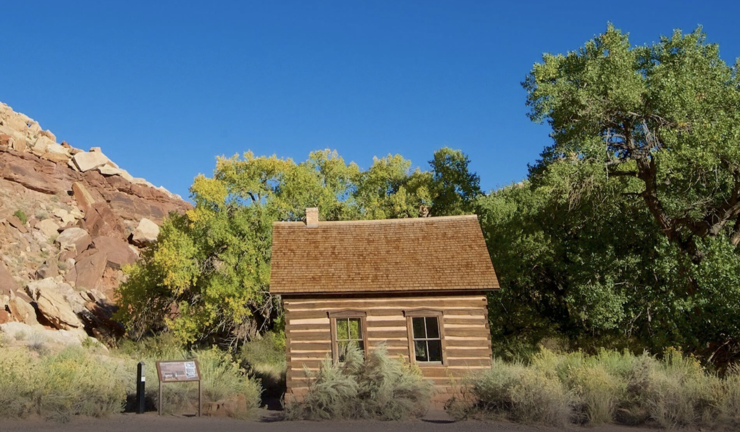
| Fruita Schoolhouse | In the Fruita district | 15 minutes | Accessible, with an audio guide. Small and genuinely affecting |
The petroglyphs are protected under the Archaeological Resources Protection Act, and the park states that acts of vandalism are punishable by up to a year in prison and a fine of up to $20,000. Stay on the boardwalks, and use a zoom rather than a closer look.
In the Fruita meadow itself: the orchards, where you can walk in and sample ripe fruit at no charge in any unlocked orchard, and the Gifford House, open daily 9:00 am to 4:30 pm from March 14 through late November. The orchard page lists all 19 orchards and what grows in each.
Length matters more than you think
If you are driving an RV, read this before the spurs
The Scenic Drive itself is paved and fine for anything. The two dirt spurs are where length becomes a problem, and the Park Service publishes two different numbers for them.
| What it says | Which park page |
|---|---|
| Accessible to all passenger vehicles and RVs up to 23 feet in length | The park roads page |
| Usually suitable for passenger cars and RVs up to 27 feet | The Scenic Drive page |
| The lots cannot accommodate vehicles longer than 23 feet | The busy season page, about the parking at the end of both spurs |
Read together, they point one way. Even if a 27 foot rig can drive the road, the parking at the end of it is described by the park as unable to take anything over 23 feet, and a spur road canyon is a poor place to discover you cannot turn around. Take 23 feet as the working number, or park at the visitor center and take a smaller vehicle down.
The Burr Trail switchbacks in the south of the park are a harder no. The park states plainly that they are not considered suitable for RVs or vehicles towing trailers. The road conditions page has every road in the park with its vehicle requirement, and the camping page covers site lengths at Fruita, where most Loop C sites run 40 to 52 feet.
Straight answers
One day questions
Is one day enough for Capitol Reef?
For the Fruita district, yes. One day covers a good hike, the whole Scenic Drive with both dirt spurs, the orchards, the Gifford House and the Highway 24 stops. What one day does not cover is Cathedral Valley or the Waterpocket district in the south, which are each a full day of their own and need the right vehicle.
What time should I arrive?
Before 8 am in the busy months, which the park names as March to June and September to October. Its own busy season page says trailhead parking lots often fill up by 10 am, and that the Grand Wash and Capitol Gorge lots fill early. Arriving at 9 usually still works. Arriving at 11 means driving rather than hiking.
How long does the Scenic Drive take?
The park says to allow about an hour and a half round trip for the 7.9 mile paved road plus the two dirt spurs. The park brochure suggests about two hours. Either way, budget more if you plan to walk Capitol Gorge at the end of it.
What is the best single hike if I only do one?
Cassidy Arch if you are a confident walker and heights do not trouble you: 3.4 miles round trip, 670 feet of climb, and you finish standing on top of the arch. Hickman Bridge if you want something shorter and gentler at 1.8 miles round trip. Capitol Gorge if you want flat and historic rather than high.
Are Capitol Reef trail distances one way or round trip?
One way, except for the Chimney Rock and Old Wagon Trail loops, which the park marks as round trip. This is the most commonly repeated error about this park. Double every other figure before you judge whether a hike fits your day.
Do I need to pay to drive Highway 24 through the park?
No. Highway 24 is a state highway with no entrance gate and no fee, and several of the best short stops are on it. The fee applies to the Scenic Drive. Full details are on the entrance fee page.
Where do I eat?
Nowhere inside the park. The Park Service states that Capitol Reef has no restaurant or lodge and no gas stations inside the boundary. Bring lunch and use the picnic area on the Scenic Drive, or drive the 11 miles back to Torrey. The Gifford House sells pie, which is not lunch, though people try.
Is there cell service in the park?
No. The Park Service states cell service is not available in the park, though it is available in most nearby towns depending on your provider. It also says not to rely on a GPS unit to guide you into the park and to use a map instead. Download what you need before you leave Torrey.
Parking guidance, trail distances, difficulty ratings, road lengths and vehicle limits on this page come from the National Park Service, primarily its busy season page and its trail guide, checked September 2026. The time estimates are ours and are labeled as such.
Next step
Set the alarm, then pick the trail
The day works or fails in the first two hours. Everything after that is a bonus.
Also useful: what the fee covers, getting here and what else is around. Or who writes this site.