Torrey, Utah / The town / Boulder Mountain
Twenty minutes from the red rock, four thousand feet higher, thirty degrees cooler
Boulder Mountain, Utah
Most people drive over Boulder Mountain without stopping. They are on Scenic Byway 12 heading for Escalante, the road climbs into spruce and aspen, and they notice it got cold. That is a waste of the best thing Torrey has that no other Utah park town has: a forested plateau in the eleven thousand foot range, with roughly eighty lakes on top of it, sitting directly above a desert. This page covers the overlooks, the campgrounds, the fishing, the dirt roads and the dates the snow decides.
If you read one section
What Boulder Mountain is, and why it matters if you are staying in Torrey
Boulder Mountain, Utah is the eastern half of the Aquarius Plateau, and it starts about twelve miles south of Torrey where Scenic Byway 12 begins to climb. It is administered by the Dixie National Forest. Capitol Reef Country, the county tourism office, describes it as the highest timbered plateau in North America, and while superlatives like that are hard to audit, the shape of the claim is right: the summit plateau is roughly seventy square miles of near flat forest and meadow sitting above eleven thousand feet.
For a visitor based in Torrey it does three specific jobs.
It is the heat escape. The rule of thumb is roughly three and a half degrees Fahrenheit cooler for every thousand feet of gain. Torrey sits around 6,800 feet. The Byway 12 summit is around 9,600. In July, when the park hits the mid nineties by two in the afternoon, the picnic tables at Singletree are in the seventies under trees.
It is where the water is. There are roughly eighty lakes and reservoirs on and around the plateau, holding brook, cutthroat, tiger and rainbow trout. That is unusual next to a desert park, and it is the reason the local fly shops exist.
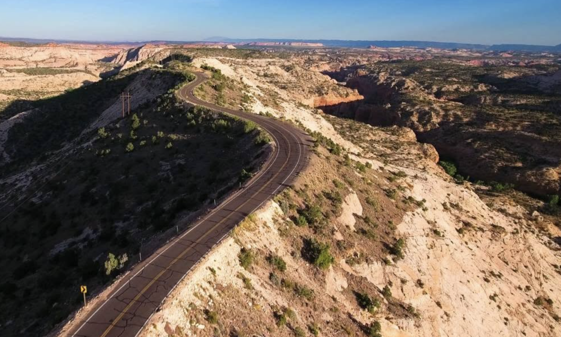
It is the view of the reef nobody photographs. From Larb Hollow and Homestead overlooks you look back down and north across the whole Waterpocket Fold, which reads as a single continuous ridge from up there in a way it never does from inside the park.
Short on time? The honest version is: drive up Byway 12 to Larb Hollow Overlook, about fifteen miles from Torrey, stop for ten minutes, and carry on. That gets you eighty percent of what the mountain offers a first time visitor. The full byway page covers the rest of that road south to Escalante.
The paved option
The drive over the top, and where to stop
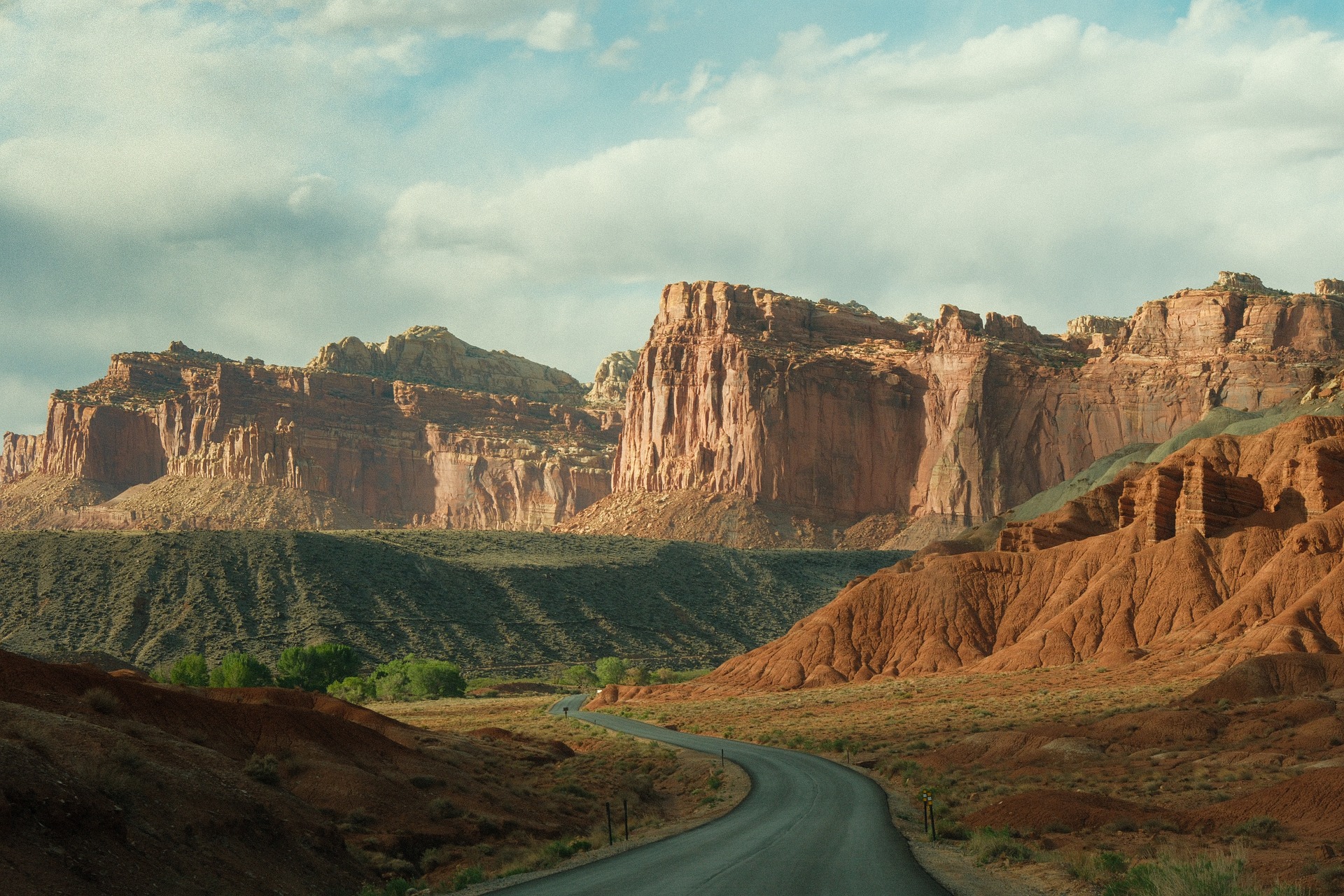
Highway 12 from Torrey to Boulder is 35 miles of pavement that gains and loses about three thousand feet. It is the only paved way across the mountain, and it is plowed but not always open in winter.
| Stop | About this far from Torrey | What you get |
|---|---|---|
| Singletree Campground and falls | 13 miles | Flush toilets, water, the trailhead for a short walk to Singletree Falls. The most civilized stop on the mountain |
| Larb Hollow Overlook | About 15 miles | Paved pullout with interpretive panels looking northeast over the Fremont River country and the reef. The easiest big view on the mountain |
| Homestead Overlook | About 26 miles | Higher, quieter, with a short accessible boardwalk. Looks south and east over the Circle Cliffs and toward the Henry Mountains |
| Wildcat Ranger Station | About 25 miles | Forest Service contact station, seasonal. Worth stopping if the gate question below matters to your plan |
| Steep Creek Overlook and the descent | 30 plus miles | Where the forest ends and the slickrock starts, dropping toward Boulder town and the Burr Trail junction |
Allow an hour and a half each way if you stop at two overlooks, not the 45 minutes the mileage suggests. The road is slow, there are cattle on it, and you will want to pull over more than once.
Distances on this page are approximate and we say so deliberately. The Forest Service, the byway signage and the county tourism material all publish slightly different mileages for the same overlooks, mostly because they measure from different points in Torrey. Treat them as within a mile or two, not as turn by turn navigation.
Where to sleep up high
The four Forest Service campgrounds
When the Fruita campground inside the park is full, which it is most summer nights, these are the closest developed alternatives. The Park Service publishes the list itself, which is the source for the figures below.
| Campground | Elevation | Sites | Water and toilets | From the visitor center |
|---|---|---|---|---|
| Singletree | 8,200 ft | 33, including two group sites | Drinking water, flush toilets | 22 miles |
| Pleasant Creek | 8,800 ft | 19 | Drinking water, pit toilets | 28 miles |
| Oak Creek | 8,800 ft | 9 | Drinking water, pit toilets | 30 miles |
| Sunglow | 7,200 ft | 9 | Drinking water, flush toilets | 18 miles, just east of Bicknell |
Sunglow is the odd one out. It is not on Boulder Mountain at all, it sits in a red rock alcove on the Thousand Lake Mountain side just outside Bicknell, and it is the lowest and warmest of the four. If you want cool nights, go to Singletree or higher.
Singletree is the one most people want, and it is the one worth knowing the detail on. The Forest Service puts it 13 miles southeast of Torrey, a mile east on Highway 24 then 11.8 miles south on Highway 12, open May to September, at $20 a night for a single site, $40 for a double and $80 for a group site holding up to 60 people, plus $7.50 per extra vehicle. Roughly half the sites are reservable through Recreation.gov and the other half are first come first served, so arriving early on a Friday is a real strategy and not just optimism.
Two elevations are published for Singletree and we are printing both. The Forest Service campground page gives 8,268 feet. The Park Service's own list of camping alternatives gives 8,200 feet. The difference does not matter to your trip, but it is the kind of small inconsistency that tells you to verify anything on a public land page that does matter, like a season date or a fee.
Pleasant Creek and Oak Creek have historically been first come first served. Verify before you drive up, because the Forest Service changes reservation status between seasons more often than you would expect.
The cabin option
The Fishlake National Forest rents the Aquarius Guard Station on the west side of the mountain, about fifteen miles south of Loa, at $30 a night. Two rooms, sleeps four inside, wood stove, propane cook stove and oven, solar lighting, vault toilet, potable water inside the cabin and at an outside hydrant. The site can hold twenty people total with the rest in tents or self contained RVs, and there are corrals for horses or pack animals. Season runs from about mid May, with the water on June through September. Reserve through Recreation.gov or by phone on 1 877 444 6777.
Dispersed camping
Dispersed camping is allowed across most of the Dixie National Forest away from developed sites, which is why you see trailers parked down the spur roads all summer. It is free and it is unregulated in the sense that nobody assigns you a spot, not in the sense that rules do not apply. Use an existing fire ring, check the current fire restrictions before you strike a match, and pack out everything including the toilet paper. Forest Service district offices publish the current restrictions, and in a dry August they change.
If you would rather not camp at all, the Torrey hotels page names the individual properties in town, and the cabins and glamping page covers the middle ground. The camping page handles Fruita and the park's backcountry.
The reason locals go up
Fishing the Boulder Mountain lakes
This is the part visitors miss entirely. Roughly eighty lakes and reservoirs sit between about 7,000 and 11,000 feet across the Wayne and Garfield county sides of the plateau, and they hold brook trout, cutthroat, tiger trout and rainbows. Some are drive up. Most are not.
The headline fish is historical: the Utah state record brook trout, 7 pounds 8 ounces, came out of Lower Bowns Reservoir in 1971 and still stands. Lower Bowns sits at about 7,450 feet and covers roughly 125 acres, reached by a dirt road off Highway 12. That record is more than fifty years old and nobody should drive up expecting to break it, but it tells you what the water here is capable of growing.
Two practical notes that save people a wasted day.
You need a Utah fishing license, and the rules are water specific. The Division of Wildlife Resources publishes limits and any special regulations by water, and some Boulder Mountain lakes carry their own. Check the current guidebook rather than assuming a statewide limit applies.
Ice off is late. The high lakes can hold ice into June. Early season on this mountain means late June, not April, and the shoulder weeks are as much about whether the road is passable as whether the fish are feeding.
If you want to fish with someone who knows which lake is producing this week, that is a guided trip. Our fly fishing page covers the Fremont River below and names the local outfitters, including the ones who run high lake trips up here.
Off the pavement
Getting on top of the plateau
Byway 12 crosses the mountain's flank. Getting onto Boulder Top itself, the flat summit, is a different proposition and it is where people get into trouble.
Bluebell Knoll
The summit, published at 11,317 feet, and the high point of Wayne County. The road up is rough, especially the last few miles, and a high clearance vehicle is the sensible minimum. There is a gate on the approach that is locked from 1 November to mid June. A low clearance car can generally reach a point a few miles short and walk from there in summer.
The Great Western Trail
The long distance route runs across here, with roughly 26 miles of it on Boulder Mountain and another 33.7 miles on Thousand Lake Mountain to the north. Mixed use, varying surface, and the Forest Service district office is the place to ask which segments are currently open to which vehicles.
What goes wrong
Three things, repeatedly. People go up in a rental sedan and find the road deteriorates. People go up in June and find snow drifts across a north facing section. And people go up with half a tank, because there is no fuel, no store and no reliable phone signal anywhere on the mountain.
If you want to see the top and you do not have the vehicle for it, book it out. Guided UTV and ATV trips run from Torrey and the local operators know which gates are open. Jeep tour operators run backcountry days as well, though most of their routes head into the park and Cathedral Valley rather than up the mountain.
Timing
When the mountain is open, and what each season is actually like
Byway 12 over the mountain is maintained year round and is plowed, but it does close temporarily in storms and it is the road most likely to be shut when Torrey itself is merely wet. The dirt roads are a different story: most high country roads are blocked by snow from November through late May or June, and the Bluebell Knoll gate is locked 1 November to mid June.
| Season | What is open | What it is like |
|---|---|---|
| Late May to mid June | Pavement yes, dirt mostly no, gates still locked | Aspens leafing out, lakes coming off ice, mud on anything unpaved. Campgrounds opening in stages |
| Late June to August | Everything, conditions permitting | The reason to come. Afternoon thunderstorms most days from mid July. Mosquitoes near the lakes in early summer |
| September to mid October | Everything, with campgrounds closing through the period | The best few weeks. Aspen color, cold nights, thin crowds, stable weather. Peak color is usually late September and it varies by a fortnight year to year |
| Mid October to April | Byway 12 only, and not always | Snowmobile and cross country territory. No services. Check road conditions before committing to a crossing |
Afternoon thunderstorms are the real hazard up here, not the cold. From roughly mid July into early September, storms build over the plateau most afternoons. You are at or above ten thousand feet on an exposed flat, which is the worst possible lightning position. Plan summit walks and lake hikes for the morning and be heading down by early afternoon. This is the same monsoon pattern that closes the park's dirt roads, covered on the road conditions page.
For picking a month for the trip as a whole rather than just the mountain, the best time to visit page compares all twelve.
Questions
What people ask before driving up
How long does it take to drive from Torrey over Boulder Mountain to Boulder?
About 35 miles of pavement. Budget an hour and a quarter without stops and an hour and a half to two hours if you stop at the overlooks, which you should. It is slower than the mileage suggests because of grades, curves and open range cattle.
Can I drive Boulder Mountain in a rental car?
Scenic Byway 12 over the mountain, yes, in any vehicle, when it is open. The dirt roads onto Boulder Top and out to the lakes are a different question, and the answer for most rental sedans is no. High clearance is the practical minimum for the Bluebell Knoll road and many of the lake spurs, and most rental agreements prohibit unpaved roads anyway.
When is peak fall color on Boulder Mountain?
Usually the second half of September into the first days of October for the aspens at higher elevations, with the lower slopes following into mid October. It moves by a week or two either way depending on the summer, so if the trip is built around color, ask the Forest Service district office or a local outfitter the week before rather than booking six months out on an average date.
Are there bears on Boulder Mountain?
Yes, black bears, along with elk, mule deer and mountain lions. Encounters with people are uncommon and problems almost always trace back to food. Store food and scented items in a vehicle or a bear canister, not in a tent, and keep a clean camp. This is ordinary western forest camping practice, not cause to stay home.
Is there cell service on the mountain?
Assume not. There are patches near the byway in places, and nothing reliable once you leave it. Download maps before you go up, tell someone your plan, and do not count on calling for a tow from a lake spur road.
Do I need a permit to hike or camp on Boulder Mountain?
No permit for day hiking or for dispersed camping on Dixie National Forest land. Developed campgrounds charge a fee. Fishing needs a Utah license. Commercial guiding needs a Forest Service special use permit, which is why you should confirm any guide operating up here is permitted. Park permits are a separate matter, covered on our permits page.
What is the elevation of Boulder Mountain?
The summit, Bluebell Knoll, is published at 11,317 feet, and it is the high point of Wayne County. Some sources round to 11,316 and a few older ones print 11,322, which is the kind of small disagreement you get between survey datums. The summit plateau is roughly seventy square miles of near flat ground above eleven thousand feet, and Scenic Byway 12 crosses at about 9,600 feet.
Campground figures come from the Park Service's own list of camping alternatives, the Singletree fees, season and route from the Forest Service campground page, the guard station details from the Fishlake National Forest cabin rental page, and elevations from published summit and plateau references, all checked September 2026. Seasonal dates move with the snowpack, so treat them as patterns rather than promises.
Next step
Build the mountain into the trip
Half a day is enough for the overlooks. A full day gets you a lake. Either way it is the cheapest temperature control available in July.
Also useful: how to get here, picking a month, what else is on and the other towns in the valley. Or who writes this site.