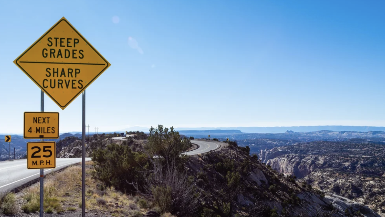
Torrey, Utah / Plan / Scenic Byway 12
It ends just east of Torrey, which is why it is on this site
Scenic Byway 12
Scenic Byway 12 is the only All American Road in Utah, designated on 13 June 2002, and it finishes at its junction with Highway 24 a few miles east of Torrey. It is also the road nobody can agree on the length of: four official sources give four different figures for the same stretch of pavement. This page sorts that out, then covers the Hogback, the 9,600 foot summit, and what the road actually does in winter.
If you read one section
Two national parks, one road, and a ridge with nothing on either side
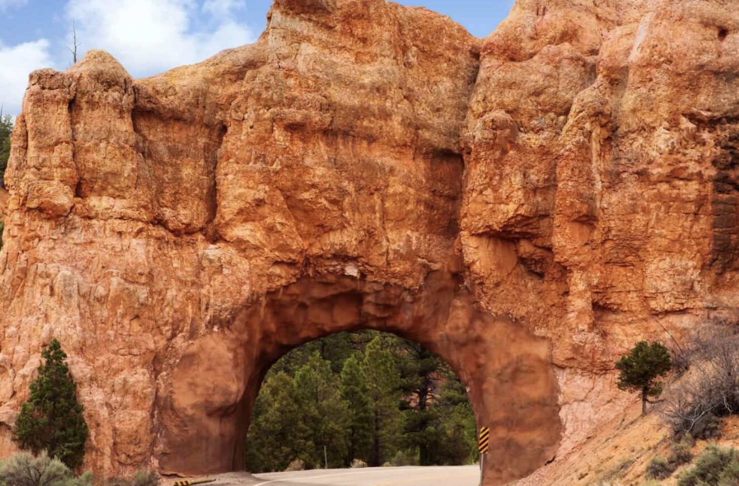
Byway 12 runs from a junction with US 89 near Panguitch, at the doorstep of Bryce Canyon, east and then north through Escalante and Boulder, over Boulder Mountain, and down to Highway 24 just east of Torrey. It links Bryce Canyon and Capitol Reef, crosses Grand Staircase Escalante National Monument and the Dixie National Forest, and includes a mile or so of pavement on a knife edge ridge with the ground dropping away on both sides.
Utah's administrative rules name it in full as Scenic Byway 12 All American Road, comprised of the Highway 12 A Journey Through Time State Scenic Byway, designated All American Road on 13 June 2002. It got there in stages: a Forest Service national forest scenic byway in 1988, a Utah state scenic byway in April 1990, then the federal designation in 2002. It is the only road in Utah at that top tier. Every other Utah byway is a National Scenic Byway, a step below.
For anyone staying in Torrey, the practical question is whether to drive it as a day out or as the way in from Bryce. Both work. The day out version is a there and back to Boulder or Escalante, and it is the better use of a spare day than almost anything else in the region.
Arriving on it rather than day tripping? The getting here page has the other three approaches and the fuel map, which matters more on this road than on the others.
A small thing that says a lot
Four official sources, four different lengths
This is the same road between the same two junctions, and the federal government, the National Park Service and Utah's own tourism office all publish different numbers for it. We are not going to pick one silently, so here they all are.
| Length | Who publishes it |
|---|---|
| 119 miles | The Utah Office of Tourism's own scenic byways guide |
| 122.863 miles | A Utah Office of Tourism article, which gives it to three decimal places |
| 123 miles | The National Park Service, on the Capitol Reef directions page |
| 124 miles | The Federal Highway Administration, and the byway's own corridor management plan |
Use 124 miles. It has the strongest backing: the federal agency that granted the designation and the byway's own governing management plan agree on it. The spread is about five miles, which is nothing on a road trip and a lot for a number four governments publish.
The endpoints are less ambiguous. Utah's administrative code defines the route as beginning at US 89 near Panguitch and running to SR 24 near Torrey, and the state code puts the west end specifically at Bryce Canyon Junction on US 89. You will see the byway described as beginning in Panguitch town itself, which is not what Utah's own legal definition says. At the Torrey end, the management plan is poetic about it: the road ends where the Cockscomb, a jagged rock formation, rises out of the earth just before the Highway 24 intersection.
The Federal Highway Administration's description of why it earned the designation is worth quoting, because it names all six intrinsic qualities, which is rare: archaeological, cultural, historical, natural, recreational, and scenic. Most byways qualify on two or three.
The real planning question
Three hours, or four days
What the agencies say
The Park Service puts the Bryce Canyon to Capitol Reef drive at about three hours on SR 12. Utah's tourism office agrees that the whole drive can be completed in three hours if you are just passing through. And Utah's own scenic byways guide recommends allowing two to four days for it.
Both are honest. Three hours is the driving. Two to four days is what the road is for.
What we would actually plan
Half a day gets you from Torrey to the Homestead and Larb Hollow overlooks and back, which is the Boulder Mountain section and arguably the best of it.
A full day gets you to Boulder, the Anasazi State Park Museum, over the Hogback, down to Calf Creek and back. Long, and worth it.
Two days lets you walk to Lower Calf Creek Falls, which is a six mile round trip to a 126 foot waterfall and cannot be done properly as a stop.
No official source recommends a direction to drive it. Utah's tourism office says only that it can be enjoyed driving either east or west, or both, multiple times. From Torrey you are starting at the high end and descending, which means the views open out ahead of you rather than behind, and that is a reasonable argument for the Torrey start if you only do it once.
Ordered from the Torrey end
The stops, with official distances
No agency publishes a milepost list for this road, so the distances below are the ones the managing agencies give from named towns. Where nothing official exists, we say so rather than estimating.
| Stop | Distance | Managed by | What it is |
|---|---|---|---|
| Larb Hollow Overlook | About 15.1 miles from Torrey | Fishlake National Forest | A view over southeastern Utah taking in the Waterpocket Fold in Capitol Reef and the Henry Mountains. Listed as a May to September facility |
| Homestead Overlook | About 26 miles south of Torrey | Fishlake National Forest | The high point of the drive for most people, at around 9,400 feet, with dispersed camping |
| Boulder and the Anasazi State Park Museum | In the town of Boulder | Utah State Parks | An Ancestral Puebloan village likely occupied from about AD 1050 to 1200, one of the largest communities west of the Colorado River |
| The Hogback | Between Calf Creek and Boulder. No official mileage published | Utah Department of Transportation | Pavement on top of a rim with slickrock dropping away on both sides. The byway's management plan calls the experience thrilling, which is government prose for white knuckles |
| Lower Calf Creek Falls trailhead | 15 miles east of Escalante | Bureau of Land Management | A 6.0 mile round trip hike, rated moderately difficult because of sandy sections, to a 126 foot waterfall. $5 per vehicle day use fee |
| Head of the Rocks Overlook | 10 miles east of Escalante | Bureau of Land Management | The single best view on the road, out across the Escalante canyons. Paved parking, accessible ramps at both ends, three interpretive signs |
| Escalante | 62 miles from Capitol Reef | Utah Office of Tourism figure | The largest town on the byway and the practical base for its middle section |
| Powell Point | 7.4 miles west of Tropic, then north on Johns Valley Road | Dixie National Forest | A prominent pink cliff landmark at about 10,188 feet, with an easy 0.7 mile trail to the point |
| Bryce Canyon National Park | 137 miles from Capitol Reef | Utah Office of Tourism figure | The west end of the byway, and the reason most people are on it |
A note on cell service, because the Bureau of Land Management publishes something unusually specific about it. At Head of the Rocks the signal is spotty at the overlook itself but good about a quarter mile to the west. More generally, BLM says cell coverage outside established towns on the monument may be poor or unavailable. Treat the whole byway as a coverage gap and download what you need.
No official source publishes where the last fuel is on this road, and we are not going to guess. Fill up in Torrey before you start, and again in Escalante or Boulder if you are continuing. This is not a road to be low on fuel on.
The part you get from Torrey
The Boulder Mountain section
From the Highway 24 junction east of Torrey, Byway 12 climbs almost immediately. Within twenty minutes you have left red rock behind and are in aspen and spruce, and the Park Service puts the summit on Boulder Mountain at 9,600 feet. Utah's tourism office gives the byway's range as 5,223 to 9,636 feet, which is close enough to the same answer.
The mountain itself goes higher than the road does. Blue Bell Knoll, its summit, is 11,322 feet by Forest Service figures, but that is a peak rather than a point on the pavement, and the two get conflated constantly.
What this section gives you that the rest of the byway does not: temperature. Torrey is a high desert town and the park below it averages 91 degrees in July. Twenty five miles up this road it is a different climate, with aspen, meadows, trout lakes and shade. In high summer that is a genuine reason to drive it rather than a scenic one.
It is also the part where you get the overlooks back toward where you came from. Larb Hollow and Homestead both look east across the Waterpocket Fold and out to the Henry Mountains, which is a view of Capitol Reef you cannot get from inside Capitol Reef. The Boulder Mountain page covers what else is up there, and the camping page has the four Forest Service campgrounds along this stretch at 7,200 to 8,800 feet.
Open, but not carefree
Byway 12 in winter
The road does not close for the season. Utah's transportation department publishes a list of the state routes it shuts every winter, and it names nine specific mountain roads. SR 12 is not one of them.
Being open is not the same as being easy. The Park Service's own sentence is the one to plan around: SR 12 has a summit of 9,600 feet on Boulder Mountain and can be hazardous to drive in the winter, and it advises checking road conditions and the state's road cameras before your trip. Utah's tourism office puts it more plainly still: the road is open year round, but after major winter storms sections might be impassable until plowed, and ice can make some sections white knucklers, especially the Boulder Mountain stretch.
We could not find any official statement about how often this section is plowed or what priority it carries, so we are not going to tell you it is cleared promptly. What is documented: it is not a seasonally closed road, it is described as open year round, and the park service calls it hazardous in winter. Plan accordingly and have Highway 24 as the fallback, since that stays low and is the route the locals use in a storm.
The state operates traction device requirements on designated highway segments when conditions warrant, with the designated list published annually. We could not retrieve the current list, so we cannot tell you whether SR 12 carries a designation. Check the state road conditions site before a winter crossing.
The road that leaves the road
The Burr Trail, from Boulder
At Boulder, a second road heads east off Byway 12 and into country most visitors never see. The Park Service describes the Burr Trail as 67 miles long, connecting Bullfrog and Boulder through Glen Canyon National Recreation Area, Capitol Reef National Park and Grand Staircase Escalante National Monument.
What it is like
Paved from Boulder to the western boundary of Capitol Reef. Inside the park it becomes a graded dirt road for an 8.5 mile stretch. In dry weather the Park Service says it is easily accessible to passenger cars.
At around mile 31.6 it switchbacks steeply up through a canyon, and those switchbacks are the famous part of it.
When not to
Wet weather changes the answer completely. The park states that when it is wet the road may be impassable for all types of vehicles, and that wet weather may make it impassable even for four wheel drive.
The switchbacks inside the park are not considered suitable for RVs or vehicles towing trailers, and the park says recreational vehicles and trailers are not recommended on the trail generally.
This is a full day of its own, not a detour off a Byway 12 drive. The road conditions page covers it with every other backcountry road in the park and the phone line that carries today's answer, and the vehicle page covers what you need to drive it.
Straight answers
Byway 12 questions
How long is Scenic Byway 12?
Officially, it depends who you ask. The Federal Highway Administration and the byway's own corridor management plan both say 124 miles, which is the figure we use. The Park Service says 123, one Utah tourism article says 122.863, and Utah's own byways guide says 119. Use 124.
How long does it take to drive Scenic Byway 12?
About three hours nonstop from end to end, which is also the Park Service's figure for Bryce Canyon to Capitol Reef. Utah's scenic byways guide recommends allowing two to four days for the road, which is the better answer if you intend to stop, hike Calf Creek or see the Anasazi museum.
Is Scenic Byway 12 scary to drive?
One section is genuinely exposed. The Hogback, between Calf Creek and Boulder, runs along a narrow ridge with the ground falling away on both sides and no shoulder to speak of. It is paved, two lanes and perfectly safe at a sensible speed, but drivers uncomfortable with heights find it memorable. The rest of the road is ordinary mountain and canyon driving.
Is Scenic Byway 12 open in winter?
Yes. It is not on the Utah Department of Transportation's list of state routes that close seasonally. The Park Service does say the 9,600 foot Boulder Mountain summit can be hazardous to drive in winter, and Utah's tourism office notes sections can be impassable after major storms until plowed. Check road cameras before you go.
Which direction should I drive Scenic Byway 12?
No official source recommends one. Utah's tourism office says it can be enjoyed driving east or west, or both. Starting at the Torrey end means descending from the mountain with the canyon country opening up ahead of you, which is our preference if you are only doing it once.
Why is Scenic Byway 12 called an All American Road?
It is the top tier of the federal byway program, and Utah has exactly one. The state's administrative code records it as designated an All American Road on 13 June 2002. The Federal Highway Administration lists it as qualifying on all six intrinsic qualities: archaeological, cultural, historical, natural, recreational and scenic.
Is there gas on Scenic Byway 12?
No official source publishes where fuel is available along the byway, so we will not guess. Fill up in Torrey before starting from this end, and treat Escalante and Boulder as the towns to check. Cell coverage outside established towns is described by the Bureau of Land Management as poor or unavailable.
Can I drive an RV on Scenic Byway 12?
The byway itself is a paved two lane state highway and RVs drive it regularly, including over the Hogback. The Burr Trail, which leaves the byway at Boulder, is a different matter: the Park Service says recreational vehicles and trailers are not recommended and that its switchbacks are not suitable for RVs or vehicles towing trailers.
The designation date and route definition come from the Utah Administrative Code, the length and intrinsic qualities from the Federal Highway Administration byway record, and the summit elevation, drive time and Burr Trail detail from the National Park Service. Landmark distances come from the Forest Service, the Bureau of Land Management and Utah State Parks, all checked September 2026.
Next step
Drive it up, or drive it out
From Torrey this is either the best half day you can have without a permit, or the finest way to leave.
Also useful: picking a month, what else is around and where to stay. Or who writes this site.