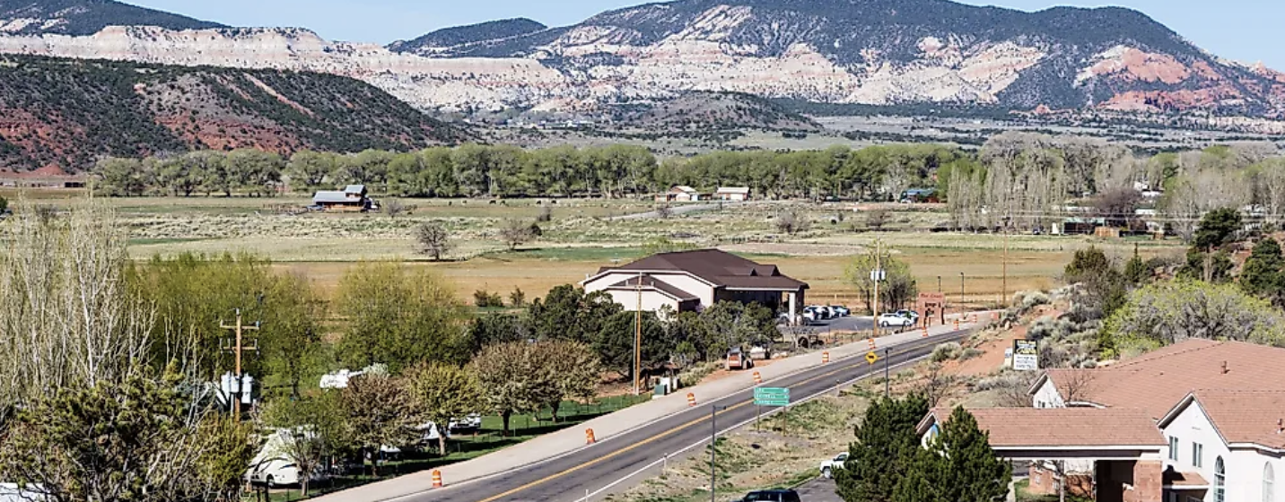
Torrey, Utah / The town / The other towns
An area the size of Delaware, with about a thousand fewer people than a single city block of Manhattan
Wayne County, Utah Towns
Driving in, you pass signs for Loa, Lyman, Bicknell, Teasdale, Torrey, Grover, Caineville, Hanksville. Some are towns. Some are a name, a chapel and eleven houses. Nobody tells you which is which, and it matters, because the difference between a town with a bank and a town with nothing is real when you have a flat tire on a Sunday. This page sorts them out: what each place is, what it actually has, and which one is worth a detour.
If you read one section
How the valley is laid out, in one paragraph
The Wayne County, Utah towns sit in a line along two rivers and one highway. Coming from the west on Highway 24 you hit Loa, then Lyman, then Bicknell, then Teasdale just off the road, then Torrey. That is the settled valley, all of it between 6,800 and 7,200 feet, all of it green and irrigated, all of it looking up at Thousand Lake Mountain on one side and Boulder Mountain on the other. Then you pass Torrey, the road drops into the park, and the country changes completely. East of the park there is Caineville, which is a scatter of buildings, and then 25 more miles of desert to Hanksville, which sits at 4,295 feet in a landscape that looks like a different planet and largely gets used as one by film crews.
Grover is the exception to the line. It is up on the Boulder Mountain side, off Highway 12, and it is a scatter of houses and a couple of lodges rather than a town.
The practical summary for a visitor: Torrey has the restaurants and most of the lodging. Bicknell and Loa have the year round services. Hanksville has the fuel you need before the long empty stretches. Everything else is scenery with addresses.
Trying to decide where to book rather than just understand the map? Our comparison page puts the three lodging towns side by side on price, drive time and what is open at night. This page is the wider orientation.
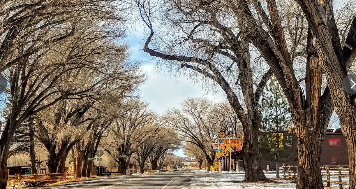
The whole county on one screen
Nine places, ranked by how much is actually there
Population figures are from the 2020 census where one exists. Three of these places have not been separately enumerated since 1950, which tells you most of what you need to know about them.
| Place | Elevation | Population | Status | What it is for |
|---|---|---|---|---|
| Loa | 7,064 ft | 516 (2020) | Town, county seat | County offices, sheriff, the only bank branch. Administrative center |
| Bicknell | 7,123 ft | 323 (2020) | Town | The health center, the historic theater, cheaper beds than Torrey |
| Torrey | 6,837 ft | 231 (2020) | Town | Restaurants, lodging, outfitters, the park gateway |
| Lyman | 7,182 ft | 196 (2020) | Town | Farming community between Loa and Bicknell. Little for visitors |
| Fremont | 7,218 ft | 167 (2020) | Census designated place | North of Loa on the way to Fishlake. Farms and the reservoir road |
| Hanksville | 4,295 ft | 158 (2020) | Town | Fuel, a motel or two, the last services before very long empty roads |
| Teasdale | 7,103 ft | 140 (2020) | Census designated place | Quiet lodging in the pinyon, two miles off the highway. No services |
| Grover | 7,116 ft | 53 at the 1950 census, none since | Unincorporated | A handful of lodges on the Boulder Mountain road. No services |
| Caineville | 4,600 ft | 20 at the 1950 census, none since | Unincorporated | A few buildings east of the park with one or two places to stay |
Add those up and you get most of a county that the census put at 2,486 people across 2,466 square miles, which works out to roughly one person per square mile. The state estimates the county has grown slightly since, to around 2,600. Either way, there are more visitors in Capitol Reef on a good October Saturday than there are residents in the entire county.
The green valley
West of Torrey: Loa, Lyman, Bicknell, Teasdale, Fremont
These five sit in the upper Fremont River valley, and they were all settled within a few years of each other in the late 1870s and early 1880s by Mormon families working irrigated farmland. They look alike from the highway: hay fields, cottonwoods, a chapel, a grid of wide streets. The differences are worth knowing.
Loa
The county seat, settled in 1878, and the one with a genuinely good name story: a returning Mormon missionary named it after Mauna Loa in Hawaii. It holds the courthouse at 18 South Main, the sheriff's office, and the only bank branch in the county, a Cache Valley Bank at 105 South Main open weekdays 9 to 5 with a walk up ATM. If you need a notary, a county record or actual cash, this is where you drive.
Bicknell
Settled in 1879 as Thurber, and renamed in 1914 for one of the best reasons any American town has ever changed its name: a man called Thomas W. Bicknell offered a thousand volume library to any Utah town that would take his name, and Thurber took the deal. It has the county's health center, the 1947 Bicknell Theater, and the annual film festival that plays on it.
Teasdale
A census designated place rather than a town, settled in 1878 and named for George Teasdale, a senior figure in the Latter-day Saint church. It sits two miles off Highway 24 up against the pinyon and juniper, it is noticeably quieter than Torrey, and it has no services at all. Several guest houses and a lodge or two, and that is the whole offer. People who stay here are choosing silence.
Lyman was originally East Loa and became its own place in 1893, named for Francis M. Lyman. Fremont, up the valley from Loa, takes its name from the river, which takes its name from John C. Fremont. Both are working farm communities. Neither has anything for a visitor beyond the drive through, and that is not a criticism, it is just true.
Worth knowing about the whole valley: the businesses here close early and many close on Sundays year round. The Park Service says so plainly in its own visitor material. If you are arriving late on a Sunday from the west, eat before Richfield or plan on what is in your cooler. The restaurants page tracks who publishes hours and who does not.
The desert side
East of the park: Caineville and Hanksville
Past the park the elevation drops by more than two thousand feet and the country stops being farmland. This is the half of the county most visitors see only through a windshield.
Caineville
Settled in 1882 on the Fremont River, and it did not take. The census counted 131 people in 1900 and 20 by 1950, and it has not been separately enumerated since. What is left is a scatter of buildings, some farmed river bottom and a couple of places to stay, set against the grey Mancos Shale badlands that make this stretch of Highway 24 look like the surface of somewhere else. Factory Butte rises north of the road here and is one of the most photographed landforms in the state despite having no visitor facilities whatsoever.
Hanksville
Settled in 1882, and it has always been a supply point rather than a farming town. It supplied Butch Cassidy and the Wild Bunch, who holed up at Robbers Roost in the desert southeast of town, and after the war it supplied the uranium prospectors working the Colorado Plateau. Today it supplies drivers, which is a direct continuation of the same job. At 4,295 feet it is the hottest place in the county by a wide margin.
Hanksville is the fuel decision point and people get it wrong. From Hanksville it is roughly 50 miles north to Green River, about 60 miles east to the Hite crossing on Lake Powell, and about 45 miles west back to Torrey, with nothing in between on any of those legs. If you are heading anywhere but back the way you came, fill up here. Do not assume a station is open at 10pm in a town of 158 people. The getting here page covers the approach routes and where the gaps are.
The practical part
Where the services actually are
This is the table we wanted when we first came here and could not find anywhere. It covers the things you only think about when you need one.
| What you need | Where | Detail |
|---|---|---|
| Emergency | Anywhere | Dial 911. Wayne County Sheriff non emergency 800 356 8757, office 435 836 1308, at 18 South Main in Loa |
| Medical clinic | Bicknell | Wayne Community Health Center, 128 South 300 West, 435 425 3744. The organization also lists a Hanksville clinic |
| Bank and ATM | Loa | Cache Valley Bank, 105 South Main, 435 836 2394, lobby weekdays 9 to 5, walk up ATM |
| County offices | Loa | Wayne County Courthouse, 18 South Main, 435 836 2765, weekdays 8 to 5 |
| Visitor information | County office | Wayne County tourism 435 425 3930, information center 435 425 3365 |
| Park information | Capitol Reef visitor center | 435 425 3791. For recorded road conditions press #1 for information, then #4 |
| Fuel | Torrey, Bicknell, Loa, Hanksville | Hours vary by season and are not reliably published anywhere. Fill up in daylight |
| Full grocery shopping | Richfield, about 75 miles west | The valley has small stores, not supermarkets. If you need a real shop, do it on the way in |
On fuel and grocery hours we are deliberately vague, because nobody publishes them reliably. Small station and store hours in this county change with the season and sometimes with the week, and we would rather tell you that than print a time that is wrong when you need it. The rule that always works: fill the tank when it hits half, and buy the food before you think you need it.
There is no hospital in Wayne County. The nearest full hospitals are in Richfield, roughly 75 miles west of Torrey, and in Green River and Moab to the east. For anything serious, expect a long transport or a helicopter. This is one reason our guides carry wilderness medical certification and why we say so in the byline.
Questions
What people ask about the towns
Which Wayne County town should I stay in?
Torrey if you want to walk to dinner and be eleven miles from the visitor center. Bicknell or Loa if you want a cheaper bed and do not mind a twenty to thirty minute drive. Teasdale or Grover if you want quiet and have already eaten. Hanksville only if you are heading east the next morning. The full comparison with drive times and price ranges is on the where to base yourself page, and the named properties are on the where to stay page.
How far apart are the towns?
Loa, Lyman, Bicknell and Torrey are strung along about 20 miles of Highway 24, so each neighbor is a few minutes from the next. Teasdale is two miles off the highway between Bicknell and Torrey. Grover is up Highway 12 from Torrey. Hanksville is the outlier at roughly 45 miles east of Torrey through the park. We have deliberately not printed exact town to town mileages because the official sources disagree with each other and with the road signs.
Is there a grocery store in Torrey?
There are small stores in the valley that cover basics, snacks and some camping supplies, but nothing that functions as a supermarket. Anyone self catering for a week should shop in Richfield on the way in from I-70, or in Green River if coming from the east. Selection and hours in the small stores change seasonally.
Why is Bicknell called Bicknell?
Because a man bought the name. The town was settled in 1879 as Thurber. In 1914 Thomas W. Bicknell offered a thousand volume library to any Utah town that would rename itself after him, and Thurber accepted. It is the county's best piece of trivia and the locals will tell you about it.
Is there cell service in the Wayne County towns?
Generally yes in Loa, Lyman, Bicknell, Torrey and Hanksville, varying by carrier and often weak. Teasdale and Grover are patchier. Coverage falls away fast once you leave the highway, and there is effectively none in Cathedral Valley, on the Boulder Mountain dirt roads or on the Burr Trail. Download offline maps before you leave pavement.
What is the biggest town near Capitol Reef?
Within the county it is Loa, at 516 people in the 2020 census. But the nearest town of any real size is Richfield, roughly 75 miles west, which is where residents go for supermarkets, the hospital and a chain hotel. The county as a whole had 2,486 people at the 2020 census across 2,466 square miles.
Population, elevation and settlement figures come from the 2020 United States census as published for each place, county services and phone numbers from the Wayne County offices page, and the seasonal closure warning from the Park Service's own visitor information, all checked September 2026. Small business hours change constantly and we have not printed any we could not source.
Next step
Pick a base and get on with it
Knowing the map is half of it. The other half is booking the right bed in the right town for the trip you are taking.
Also useful: Torrey itself in depth, the mountain above the valley, campgrounds across the county and what the park costs to enter. Or who writes this site.